
Our solutions, seen from space
Poseira: Satellites in service of the ocean
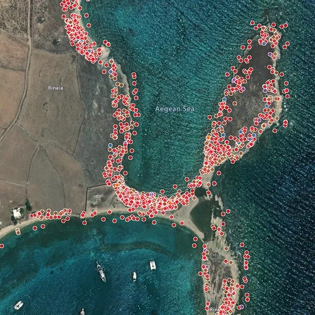
With Poseira (formerly Plastic-i), a British Earth observation specialist, we track floating debris from space. Satellite imagery and artificial intelligence reveal where pollution accumulates, season after season, allowing us to deploy our Mobulas to the right locations.
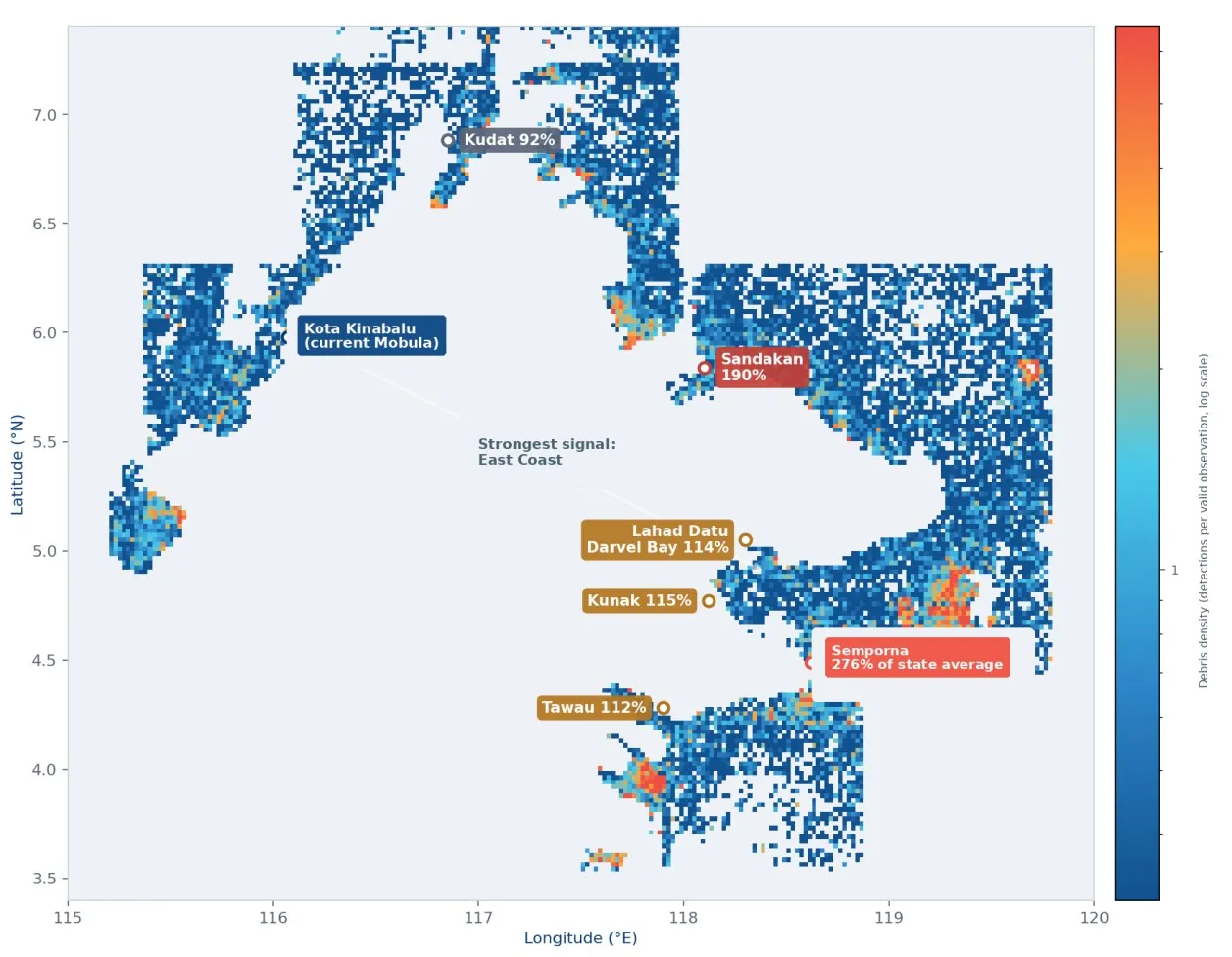
Analysis by The SeaCleaners Swiss, Poseira data.
How it works
Observe, detect, target
Observe
European Sentinel satellites capture images of the sea every few days. Each pixel covers 10 by 10 metres.
Detect
Poseira's artificial intelligence detects slicks of floating debris, even through clouds.
Map
Month after month, density maps highlight recurring debris accumulation areas.
Act
Our teams target pollution hotspots and monitor their trends year after year.
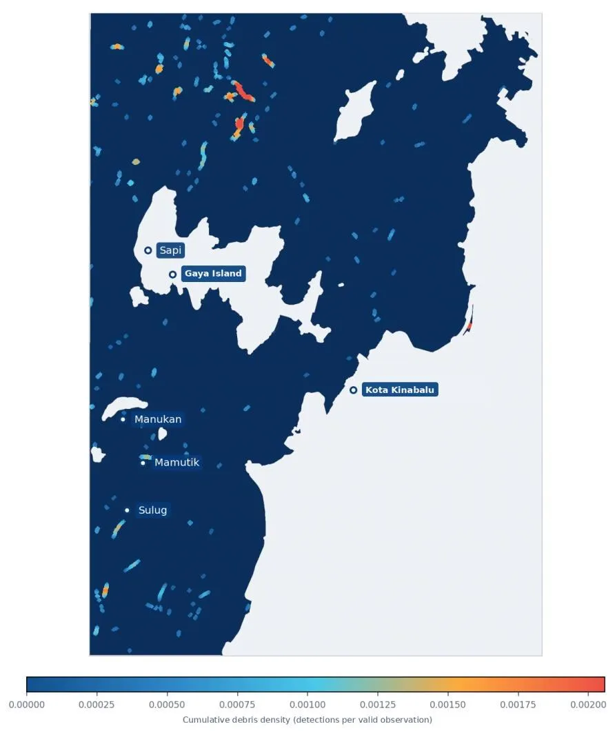
Our study in Sabah, 2017 to 2025
9 years of satellite imagery to understand Kota Kinabalu Bay
We commissioned Poseira to conduct a pioneering analysis: 9 years of satellite archives covering Kota Kinabalu Bay and the entire coast of Sabah, Malaysia. For the first time, alongside our partner Marine Research Foundation, the daily cleanup efforts of Mobula 8.2 are integrated into a statewide pollution map.
- ✓Where floating debris accumulates and returns
- ✓When pollution risk peaks, month by month
- ✓An independent baseline to measure our future impact
Key study figures
What the satellites reveal
11,500
satellite images analysed
From 2017 to 2025, despite frequent and heavy cloud cover in Sabah.
88%
of debris concentrated in 5% of the bay
In Kota Kinabalu Bay, detected pollution is concentrated in just a few areas: targeting these hotspots makes every cleanup mission more effective.
3 times
the Sabah average in Semporna
On the east coast, Semporna stands out significantly: a priority area to investigate on the ground for a future deployment.
For full transparency: satellites detect floating debris without always distinguishing plastic from drift wood or natural vegetation. We therefore cross-reference these maps with onboard sorting data from the Mobula, sharing only what the data conclusively demonstrates.
In the field
What this changes for our expeditions
Targeting hotspots
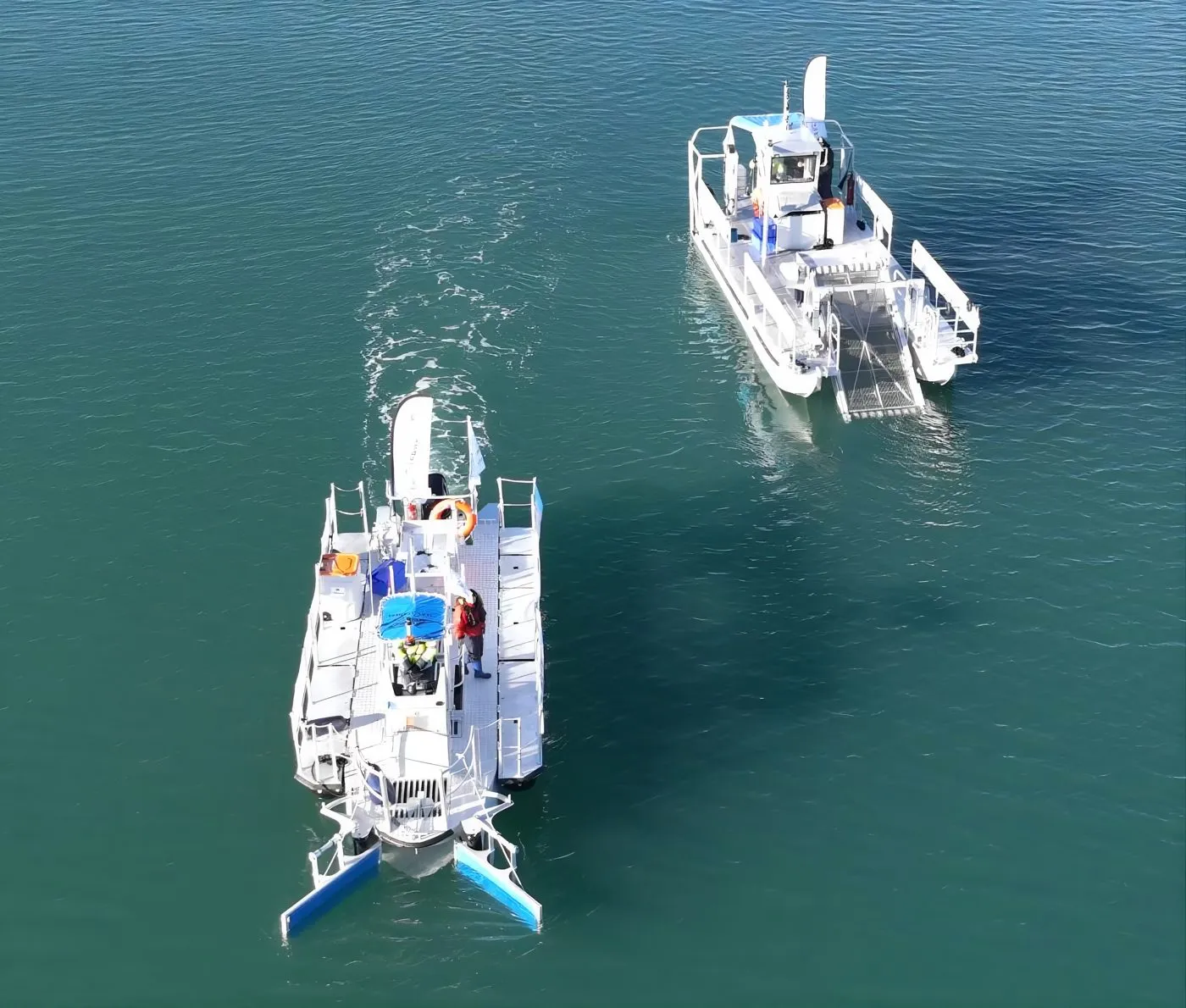
The Mobula focuses its operations where debris returns, retrieving more waste during each cleanup day.
Seasonal planning
During the northeast monsoon in November and December, debris slicks are longer: we intensify our collection efforts accordingly.
Preparing next steps
Mapping of Sabah guides the selection of our next operational areas, which are always confirmed through on-site scoping missions with our local partners.
Full report
The study report, upon request
Our comprehensive report is available in English and French. Partners, donors, researchers, or journalists: feel free to contact us, and we will gladly send you a copy.

Our other solutions
A comprehensive chain, from detection to recycling
Seeing further to act with greater precision
Every donation helps us turn these data into meaningful action on the water. Thank you for being part of this journey!


